Posts

Call of the Wild: Soundscapes

Image
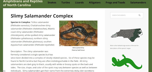
Soundscapes of Summer This is for all the nature-loving, outdoor camping, backyard exploring, curiosity-driven, children of summer.   The art of listening to the sounds of nature can soothe the soul, but identifying those sounds can put to rest the fears of those who are frightened by what may be lurking in the shadows.   Amphibians and Reptiles of North Caroline website,  herpsofnc.org ,  is a colorful and user-friendly website that can help the novice as well as the intermediate nature lover conquer their fear of the wild and appreciate the sights and sounds of their natural environment. The young and young at heart will find it easy to navigate the simple and prominent page headings.   The layout of the homepage is unencumbered by graphics, chart, forms, and small writing.  The automatic slideshow that begins once you land on the page shows a picture of the animal that would best fit into each one of the headings on the page.  this feature will help uncertain nat

Climate Change is Imminent

Climate Change is imminent for everyone. The Barrier Islands of Virginia especially are no different.  This post examines the climate data of the Barrier Island region of Virginia.  It particularly looks at Chincoteague and Assateague Island's waters.  How do ocean currents behave near this stretch of ocean territory?  An element of Assateague Island beach that we found most shocking was the temperature of the water.  It was incredibly cold. So cold in fact that it was painful to stay in the water even though the temperature was a very balmy 101 degrees and a heat index of 110.  Surely there is an explanation as to why the water was so cold. With these questions and concerns in mind, I chose to look for an explanation.  I started with the NOAA website formerly known as the National Oceanographic Data Center (NODC).  It is now the National Centers for Environmental Information (NCEI). https://www.nodc.noaa.gov/OC5/regional_climate/ This website and its reports have great d

Chincoteague and Assateague: What is the ground made of?

Image
"For every 1-foot rise in sea level, it has been estimated that coastal barrier islands move 100 to 1,000 feet inland."  Photo taken from the Federal Wildlife Service refuge resources https://www.fws.gov/uploadedFiles/CCP_Chapter3(1).pdf Perhaps one of the strangest things about Chincoteague is the land itself.  This week I used the Web Soil Survey(WSS) to try and understand one of the craziest things we saw on our visit to Chincoteague.  If you pay attention as you drive across the bridge to Chincoteague, you will see it too.  And you will wonder as my son and I did.  Why in the world would anyone build on an island where the strip of land is barely above the water level of the marsh.  Photo is taken from realestate.com   This is one of many homes on Marsh Island  That's right. There is a marsh island just off the shore of the island.  And it is amazing that so many large residential building structures were ever allowed to be built there.  And s

Virginia's Barrier Islands

So just how many barrier islands does Virginia have? It depends on the year or the decade.  I found sources that say 23, another 20, and yet another says 14. What is common to each source is that Virginia's barrier islands are constantly changing.  Strong storms move sand and are constantly reshaping shorelines and exposing new inlets and lagoons all along the coast of Virginia's Eastern Shore. It was fun creating a personalized map of this incredible area of study.  Part of the intrigue was in getting to know Google's MyMap.  Placing the points were fairly easy. However, I ran into some difficulties with placing the marker for each barrier island. 1. The default map did not show all the islands. 2. The location coordinates for some of the islands were in the ocean.  This I attributed to the migrating island shorelines. 3. I wanted to show the landscape. It is very beneficial having Base Map options.  The satellite map option made illustrating this area much easi

Freshwater Marshes and Wild Ponies

Image
July 18, 2019 Today's adventure took us through the freshwater marshes and into Assateague beaches.  The smell was everything the Park Rangers told me it would be.  Very different from the tidal saltmarshes, here it smelled like stale algae and swamp.  The grasses here grew shorter and looked soft and velvety.  There were pine trees and lots of swamp roses.  And of course, there were the ponies.  A good portion of the herd had come closer to the edge of their fenced-in area to graze.  Alongside them were larger gatherings of egrets.   As we moved further down the road the smell grew stronger and the color of the water grew stranger.  My interview with the Park Ranger prepared me for what I was observing.  Throughout the summer breeding months, the rangers create deeper water pools using artificial dams.  This helps to trap rain waters for the summer birds who depend on deeper waters and allows the rangers to drain them for the winter migratory birds.  It was about 7:00

First Encounter

Image
Today, July 17, 2019, I arrived on Chincoteague Island.  It was a nice drive through the Eastern Shore of Virginia.  I decided to make this journey to get a close up look at the salt marshes for myself.  I, of course, brought my trusty companion along with me- my curious outdoorsy son. Perhaps the first part of our trek that perked him up from the seven and a half hour was passing the NASA flight facility on Wallops Island . The highlight was seeing a NASA C-130 outside of the hangar on their grounds.  NASA  is using the C-130 in support of the Atmospheric Carbon and Transport-America or ACT-America campaign which is monitoring atmospheric levels of carbon and greenhouse gases.  I gathered lots of information about their efforts in monitoring GHGs that I will have to put in another post.  It is quite fascinating seeing how ozone damages plants and how that impacts the insects and bugs in an ecosystem. But again, that is information for another post. We crossed the bridge over